Whilst Trough Lane currently just about survives, in the 1850’s it was part of a web of streets that have, sadly, been largely eradicated by the development of industrial warehouses. The 1854 Ordnance Survey map shows that Trough Lane emerged from Hacking Lane to the west and continued on to a junction of Balk Lane (leading north) and Pasture Lane (leading south). To the southern edge of Trough Lane was the substantial Field House (now entirely demolished), and a draw well. To the northern edge of Trough Lane were substantial limekilns and South Elmsall Quarry.
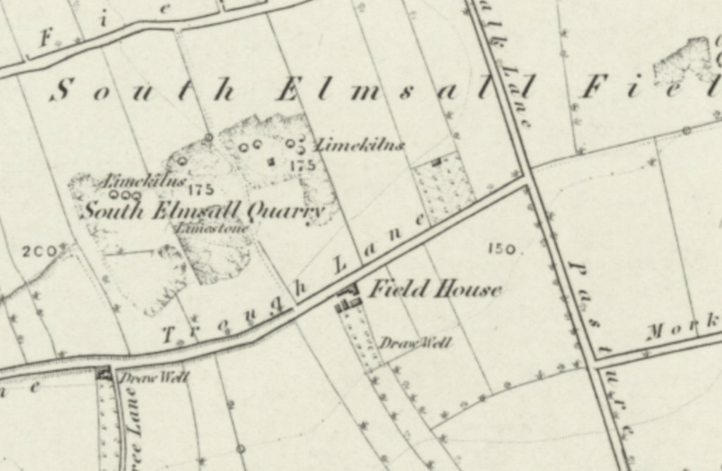
This network formed part of what was South Elmsall Field, largely an agricultural area, interspersed with lime quarrying, which may lead some to question how planning permission for the entire are to be wiped off the map by industrial units was granted.