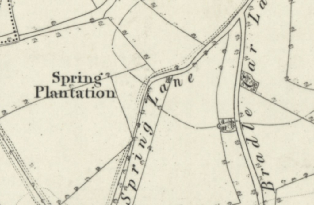
At the time that the 1854 published Ordnance Survey map was surveyed, what is today Hood Street was a section of what was then known as Spring Lane. This meandering lane led south/south west towards the hamlet of Frickley and on to Frickley Hall, via the Whincover Plantation. Today Hood Street begins at an intersection with Bradley Carr Terrace, which in 1854 was Bradle Car Lane. The area to the north west of Spring Lane was the Spring Plantation.