In the 1770’s Thomas Jeffrey’s created excellent surveys and maps across Yorkshire and through one of these we know that a windmill was located on Mill Lane at least from the 1760’s and in operation in 1770. Thomas Jeffrey’s survey also tells us that a water wheel was also in operation on Mill Lane in the 1770’s, which makes perfect sense as we know that a pump was later in operation on Mill Lane and a small stream or rivulet used to run alongside the road and down High Street, on old photos and postcards. The 1828 Henry Teesdale map of Yorkshire again recorded that the windmill was still in operation in the 1820’s.
In the years preceding the first Ordnance Survey map of South Elmsall various lands around what is Mill Lane were sold, which tell us that Mill Lane was almost exclusively agricultural in nature. In January 1827 the freehold lands of the late Mary Stocks were auctioned. These lands were extensive and included lot 21, a close of land known as North Croft and lot 22, a close of land known as Windmill Field Allotment (also known as Top of Town Close), in the occupation of Mr G. Smith.
In May 1844 the estate of the late Samuel Rowley, a farmer of South Elmsall, took place at Elmsall Inn (the home of William Wood). Samuel Rowley’s farm occupied a large part of what is today High Street, Upper Northcroft, Lower Northcroft and wider area including the area of the windmill. This included a farm house, barns, cow houses, gardens and various plots of arable land, pasture and meadow. These were called The Croft, Gib Ing, Upper Norcroft, Lower Norcroft, Townend Close, First Shut Close (also known as New Close), Wall Close, Old Quarry Close, Turnpike Close, Far Manifold Hill, Near Manifold Hill (also known as Witch Flatt), Little Manifold Hill, Trough Close, Little Trough Close, Little Quarry Close (also known as Windmill Field), The Langleys, Green Field, New Close, The Hatchet (also known as West Field Close), The Hadcrofts, the Common Closes, Lockey Ing, Fleak Close and Old Hill. It was said that the buildings were commodious and in “good repair” and the land was largely tithe free and “in an excellent state of cultivation.”
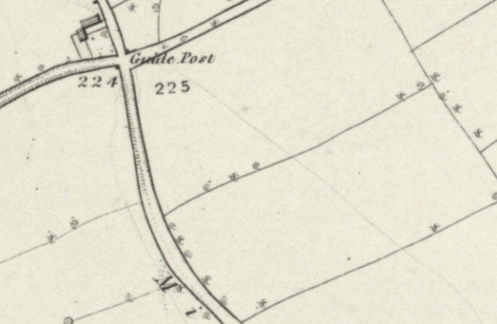
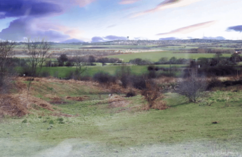
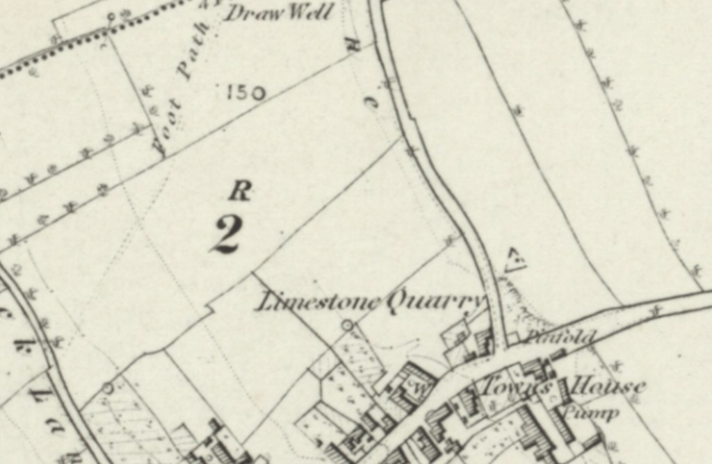
When the 1854 published Ordnance Survey map was surveyed, in 1849, Mill Lane was very much an important route through South Elmsall, running from what is now High Street, north westerly towards the junction of Minsthorpe Lane, Dale Lane and Kirkby Bridge Lane (now also known as Minsthorpe Lane). At it’s southern end Mill Lane was in a built up area where a towns house (poor house), pump, quarry and South Elmsall’s pinfold were located, at the junction of what is now High Street.
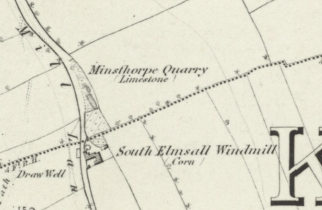
At it’s mid point Mill Lane featured Minsthorpe Quarry and South Elmsall Windmill, where corn was milled. Here a draw mill was also located.
At it’s northern end, where Mill Lane met with Minsthorpe Lane, Dale Lane and Kirkby Bridge Lane (also known as Minsthorpe Lane today) was a guide post.