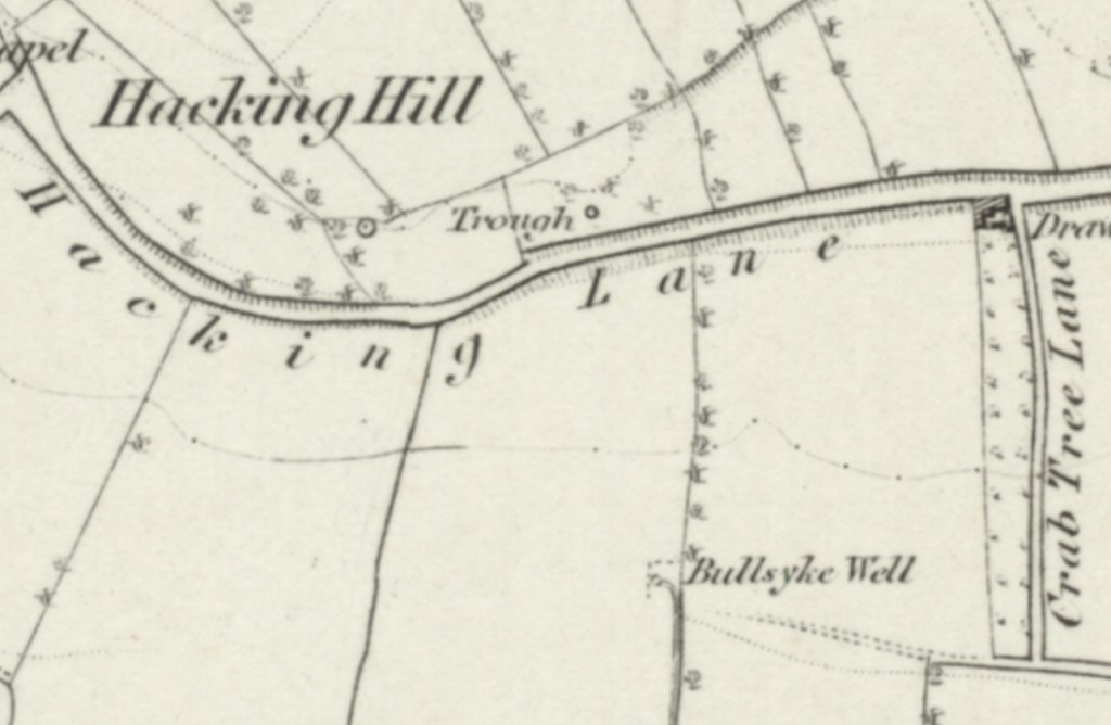
The 1850’s Hacking Lane followed the same route as it does today, across Hacking Hill. The 1854 Ordnance Survey map shows that as Hacking Lane led from Chapel Lane, in an easterly direction, it passed by a trough, on the northern side of the road, with Bullsyke Well being to the south of the road. Shortly afterwards Hacking Lane was intercepted by a junction, where a draw well was found. Leading south from this junction was Crab Tree Lane, and continuing on to the east was Trough Lane, as today. To the northern side of this junction were extensive limekilns and South Elmsall Quarry.
In November 1853 large areas of lands across the area were auctioned at the Chequers Inn (home of William Wilson) that were the freehold estate of the late George Booth. These included many closes of arable, pasture and meadow land, split up into lots, including lot 9, a close of meadow known as Hacking Ing. The land was in the occupation of James Brook.