In January 1827 the freehold lands of the late Mary Stocks were auctioned. These lands were extensive and included lot 25, various closes of land, including Common Allotment and “the road”, presumably Common Lane (now Doncaster Road), in the occupation of Mr G. Smith.

Doncaster Road appeared on the first Ordnance Survey map published in 1854 as Common Lane. Near to the Chequer Inn the Common Lane continued on to Common End, where the towns house (poor house) was located, along with Common Well, here another pump was located.
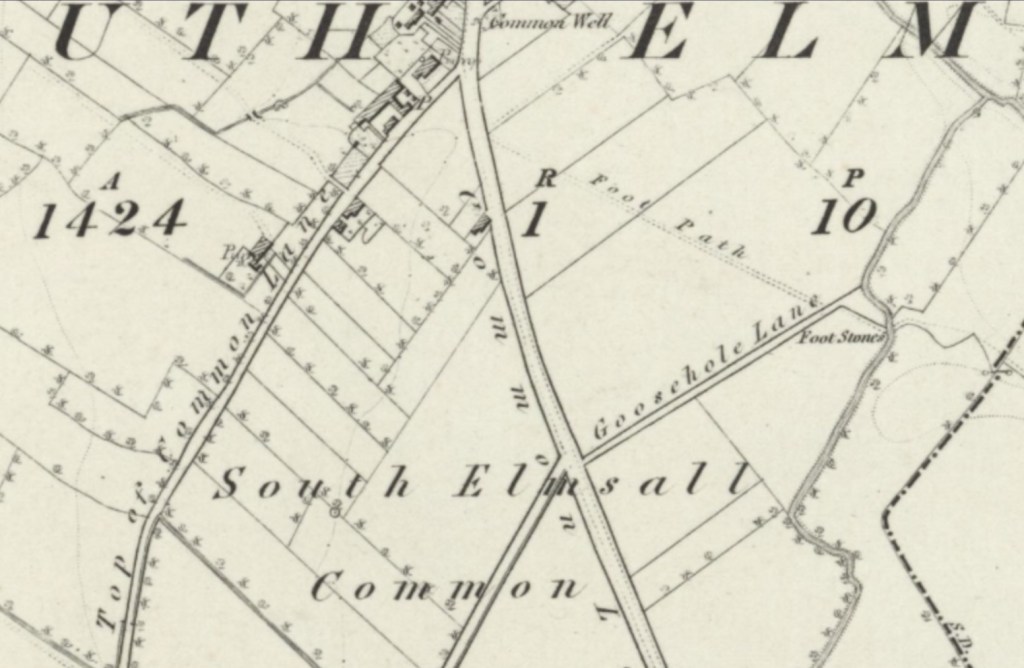
Here Common Lane continued on towards Hooton Pagnell, passing through South Elmsall Common. Two lanes here branched off south west, Top Of Common Lane (where another pump was found) and Frickley Lane. To the north east ran Goosehole Lane, which reached the beck and foot stone crossing.